


WE CAN HELP
RANCH OWNERS, MANAGERS & HUNTERS
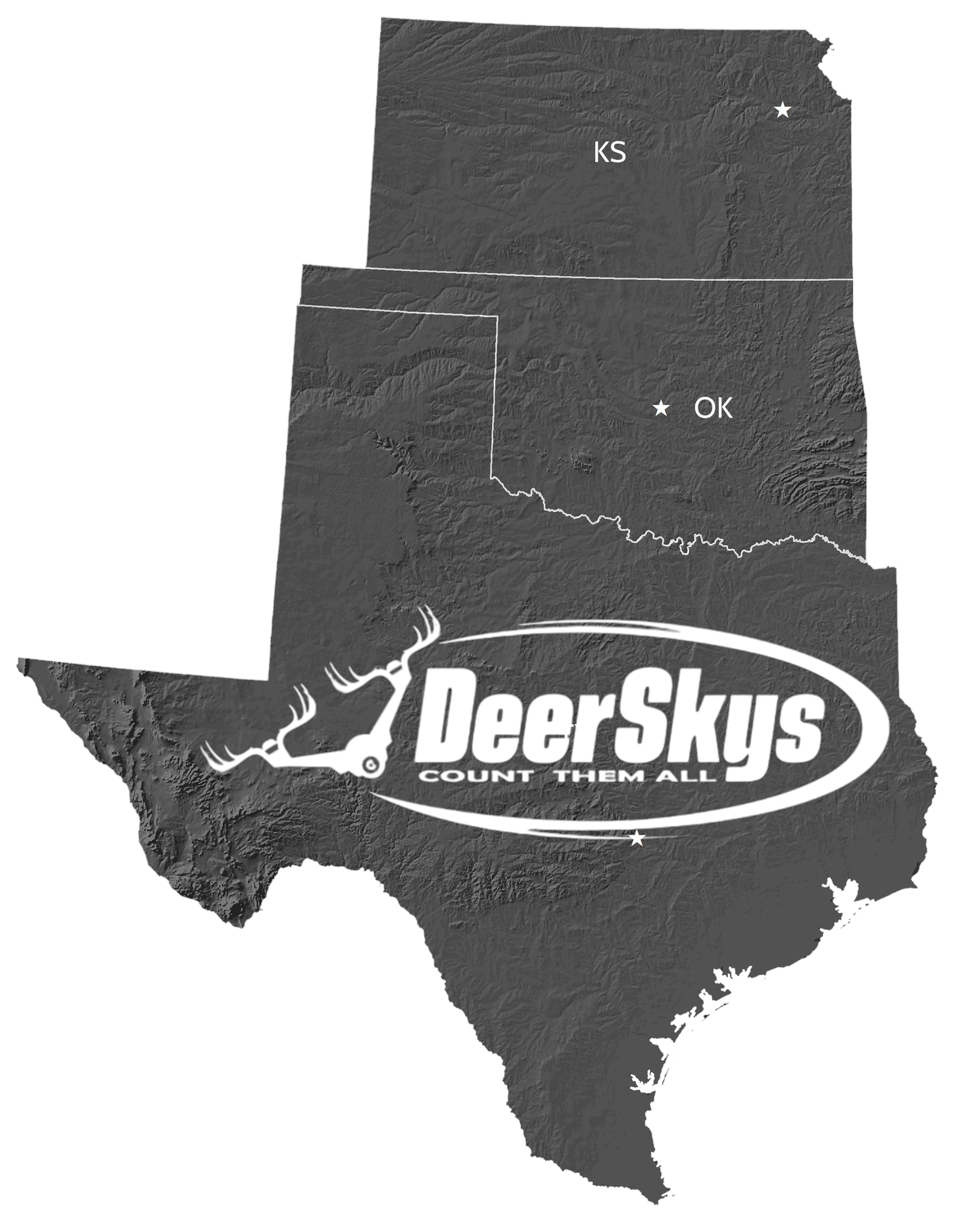
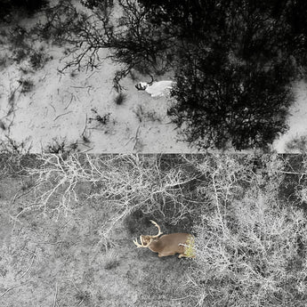
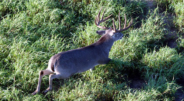
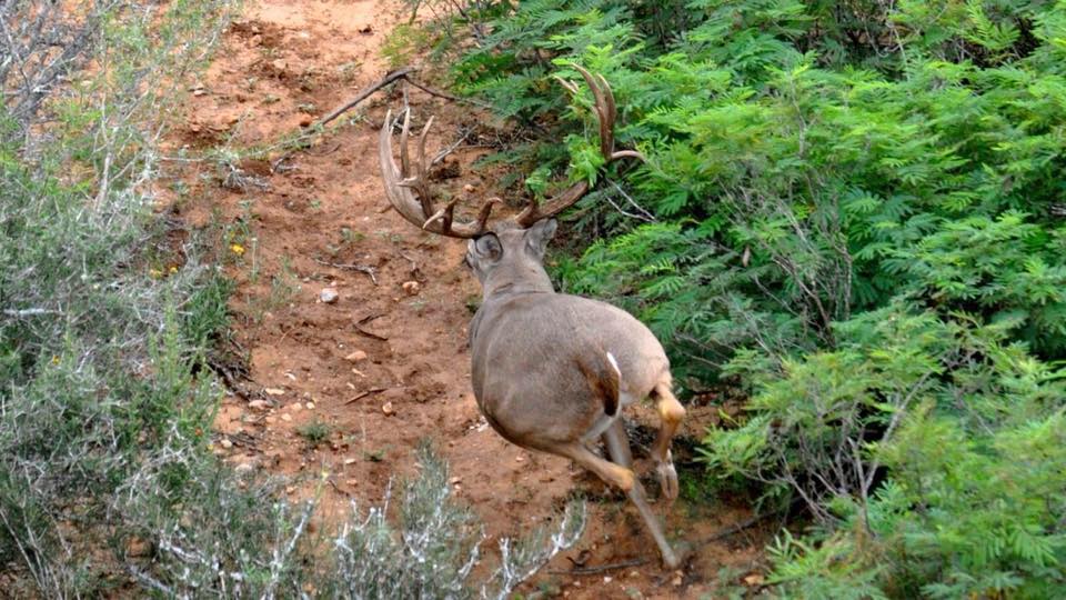
DeerSkys is fully licensed by the FAA and Texas Parks & Wildlife to conduct all of your aerial wildlife services. Any day of the week, per our schedule, we offer a range of services including thermal drone game surveys, 2D and 3D ranch mapping, game-fence inspections, deer location, predator management and more. Serving South Texas to Kansas, we cater to properties of all types, sizes, high-fence to low-fence. Providing our clients with TPWD industry wildlife counts and submission-grade reports that service any game count requirements. Whitetail or exotics, Buck-to-doe ratios, wildlife per acre, property and harvest recommendations to submit to your ranch manager & wildlife biologist. Additionally, DeerSkys conducts deer lease surveys, providing lease hunters with accurate herd wildlife counts and thermal aerial mapping to identify optimal stand placement, travel routes, bedding locations and much more. Trust DeerSkys for reliable data and expert insights to enhance your family-owned ranch property or lease hunting land success. All at a reasonable rate.
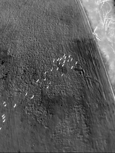
"Helicopter surveys greatly underestimate the actual number of deer."
"After analyzing the results they discovered helicopter surveys greatly underestimate the true deer population. The percentage of marked deer sighted during the surveys varied from 17 percent to 65 percent. The average count for all surveys combined was just 33 percent. In other words, only about one-third of all deer on an area are seen during a typical 100 percent-coverage helicopter survey"
-Dr. Mickey W. Hellickson, Wildlife Biologist
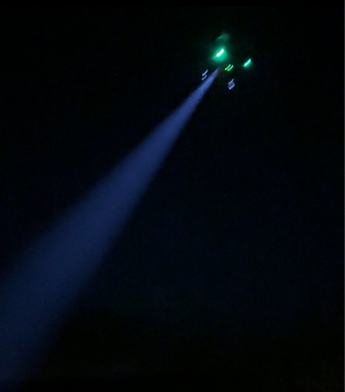
SPOTLIGHT ADD-ON GAME ID
From 400 feet, DeerSkys' can identify wildlife at night without disturbing them. When your management plan requires precise data on specific trophy deer, including age estimates, buck-to-doe ratios, and fawn crop counts, the Gold Survey package delivers for a morning or night survey mission. This package provides survey data needed for your TPWD Survey Report, ensuring a submission-grade Wildlife Survey and Management Plan, all included in our Gold package. Contact us for details.
ADVANCED TECH, LESS STRESS ON WILDLIFE WITH DEERSKYS...
PINCHSTONE WATERS
"deer, elk and pronghorn associate helicopters with mortal danger. This places extreme stress on animals, especially fawns, and limits the usefulness of helicopter game counting because, as we observe, animals increasingly hide from them."
TPWD
"The biggest drawback to a helicopter census is the cost. Increased costs in fuel, liability insurance and general maintenance, are passed on to the consumer. Costs will also vary between operators."
TEXAS HUNTING TIMES
"The most important finding is that helicopter surveys result in a significant undercount of the deer present on a property. The original research showed that an average of approximately 34 percent of deer are counted."
BUCK MANAGER
"Studies indicate that accuracy of helicopter surveys in South Texas brushland is fairly consistent, but they can underestimate deer density by 60-70%"
FEATURED POST

DeerSkys Thermal Drone Wildlife Surveys Made Easy... Better Results!
Traditional methods for wildlife surveys are often time-consuming, labor-intensive, and may not provide the comprehensive data needed for effective management. The good news is that ranchers and wildlife biologists can...

Advanced enterprise thermal & camera zoom
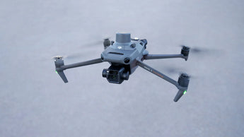
WE USE THE INDUSTRY BEST THERMAL SURVEY & MAPPING DRONES FOR YOUR JOB
• DJI Matrice 30T The next level performance with high-resolution thermal, extreme performance, incredible portability, and lightning-fast deployment. The best wildlife survey tool on the market. Incredible 200X zoom capabilities, 48-megapixel wide angle plus a telephoto zoom, 640 x 512 enhanced thermal camera and IP55 waterproof and environmental resistance make this DJI's most durable system yet.
• DJI Mavic 3T The thermal camera which has 640 x 512 pixels. A 48-megapixel wide angle plus a telephoto zoom which can be pushed as far as a 56x digital hybrid zoom for wildlife identification.
• DJI Mavic 3 Enterprise The Mavic 3 Enterprise wide-angle 4/3 CMOS, 20MP sensor has a mechanical shutter to prevent motion blur and supports rapid 0.7-second interval shooting. Complete mapping missions with extraordinary efficiency without the need for Ground Control Points. High-resolution visual imagery makes the M3E a perfect ranch mapping tool.
Partner with DeerSkys
We will Contact You Within 1 Business Day
Unlock a range of ranch services, from precise wildlife thermal drone surveys to a variety of other offerings. With extensive hands-on experience in ranch management, DeerSkys is committed to helping you achieve your monthly, quarterly, or annual goals at a reasonable rate.
Jerry Shinn, Managing Partner
512.675.0006
jerry@deerskys.com