
DEERSKYS CUSTOM SURVEY PROCESS
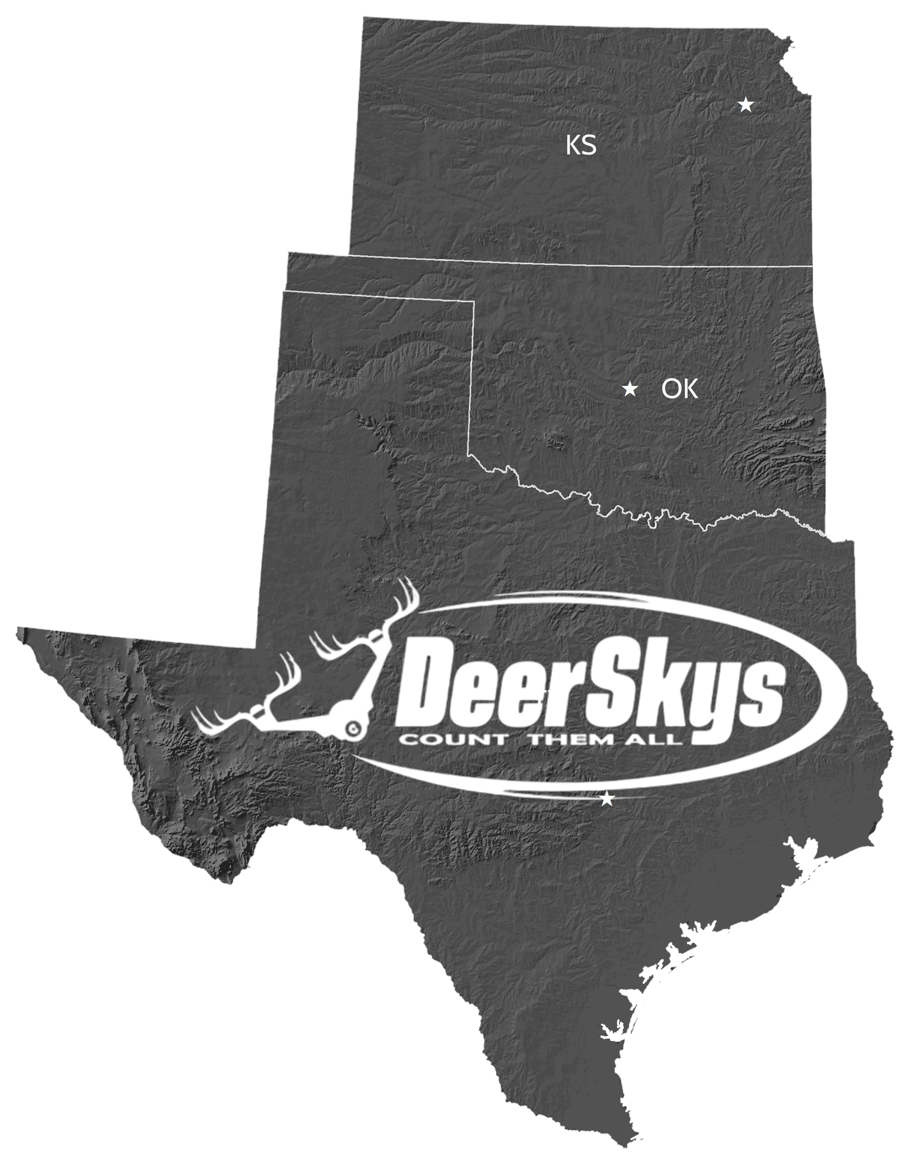
DeerSkys knowledge and advanced equipment can be a reliable tool that ranchers and wildlife biologists depend on for efficient and precise thermal wildlife surveys and related management plans. We partner with wildlife biologist to get a much better census that removes a lot of guessing. Let's get started today.
CONTACT DEERSKYS
PHONE: 512.675.0006
EMAIL: jerry@deerskys.com
SELECT A WILDLIFE SURVEY PLAN
WE HAVE 3 WILDLIFE SURVEY PLANS THAT SHOULD FIT YOUR SURVEY GOALS. PLUS, WE CAN MODIFY ANY PLAN TO SUIT YOUR NEEDS.
• BASIC SURVEY PLAN
• SILVER SURVEY PLAN
• GOLD SURVEY PLAN
(For details, go the top menu under Pricing Estimate)
DEERSKYS WILL MAP & CONFIGURE YOUR PLAN
DEERSKYS THEN MAPS YOUR PROPERTY. SETTING ALL BOUNDARIES AND CONFIGURING THE BEST AUTOMATED FLIGHT GRID FOR YOUR PROPERTY, SPEED AND ALTITUDE. ALTHOUGH THE PRE-PLANNED FLIGHT MISSION IS AUTOMATED WHICH KEEPS THE FLIGHT ON PATH SO NO SECTION IS MISSED, ONCE WE DETECT WILDLIFE IN THEREMAL, WE MANUALLY TAKE OVER AND GATHER ALL NEEDED DATA.
SCHEDULE YOUR SURVEY
IN THIS STEP YOU ARE SENT THE SURVEY MISSION PLAN AND WE DISCUSS ANY CHANGES THAT NEED TO ME MADE. WE SCHEDULE YOUR SURVEY DATE WHETHER A DAY OR NIGHT MISSION BASED ON SELECTED PLAN AND NEEDS.
THE SURVEY
2-3 DAYS BEFORE THE SURVEY DEERSKYS WILL CONTACT YOU LETTING YOU KNOW THE TIME WE WILL BE ARRIVING AT YOUR PROPERTY AND FINALIZING ANY LAST-MINUTE DETAILS.
WE WILL ARRIVE, SET UP IN THE BEST LOCATION AND START AND FINISH YOUR WILDLIFE SURVEY. AFTER THE SURVEY IS COMPLETE, WE WILL GIVE YOU A PRELIMINARY REPORT AND AN UNOFFICIAL ESTIMATE AND BREAKDOWN.
ONCE BACK IN THE OFFICE WE METICULOUSLY GO THROUGH THE FLIGHT MISSION VIDEO AND PHOTOS AND COMPILE YOUR COUNT. THAT DETAILED REPORT WILL BE BASED ON YOUR SURVEY PLAN CHOSEN.
SURVEY DELIVERABLES
DEPENDING ON YOUR SELECTED SURVEY PLAN, YOU WILL RECEIVE HARD AND DIGITAL COPIES OF THE FOLLOWING:
Survey Deliverables:
- Thermal Wildlife Survey
- Game Location Map
- T60 Spotlight for Wildlife ID
- Video / Photos of the Survey
- TPWD Report - Submission-Grade Wildlife Survey & Management Plan
- Immature, Medium, Mature Bucks / Does, Fawns / Exotics, Hogs, Coyotes, etc.
- Buck/Doe Ratio, Fawn Crop Ratio, Observed Deer Per Acre
- Submit to Current Wildlife Biologist or TPWD
(Please refer to your survey plan selected to determine your deliverable. Plus, they will be listed in your proposal. Any changes can be made, even on survey day)
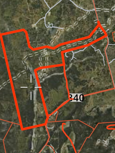
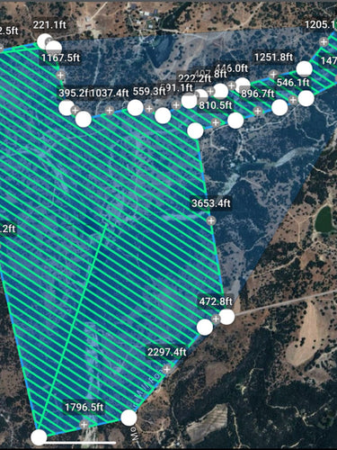
TAKING YOUR RANCH AND TURNING IT INTO A "HIGH TECH" AUTOMATED SURVEY MISSION
AUTOMATED FLIGHT GRID, SO ITS ALL COVERED CONSISTANT AND REPEATABLE FOR EVERY WILDLIFE SURVEY
DEERSKYS MATRICE 30T
BY FAR THE INDUSTRY LEADING WILDLIFE THERMAL SURVEY DRONE

MATRICE 30T SPECS
State-of-the-Art Thermal Imaging: The Matrice 30T comes with an integrated thermal camera, crucial for spotting and tracking deer, even in dense forests or at night. Superior Wildlife Monitoring: Enhanced with high-resolution cameras with 200x Hybrid zoom, you will never miss a thing when flying! Combined with a High Res 640x512 Thermal Camera, you get an unparalleled, powerful tracking drone!
INTELLEGENT FLIGHT CAMERA
•48MP Zoom &12MP Wide Camera (3840×2160 video) •640x512 Thermal Resolution •200X zoom (Deer ID from 400ft)
RTK BUILT IN
RTK stands for real-time kinematic, which is a technology that allows the DJI Matrice 30T RTK drone to achieve centimeter-level positioning accuracy. This level of precision is important for tasks such as wildlife survey grid flights and staying on-line to target and capture wildlife count accuracy and not double counting.
T60 SPOTLIGHT
T60 matrix lamp, equipped with two sets of optical lenses, it can emit 16 Degree uniform light column, the illumination distance is more than 350', and the 50m exploration area is more than 300sq ft. Brightness adjustment, strong light explosion to ID game from incredible heights.
IP55 WATERPROOF
RAIN, SNOW WIND 50 MPH, 56 MPH SPEED
BUCK GROUP
REQUEST A FREE DEEYSKYS SERVICES BROCHURE PACKET
DEEYSKYS SERVICES BROCHURE PACKET. REQUEST A FREE BROCHURE HERE
Partner with DeerSkys
Add a short description for this section
Unlock a range of ranch services, from precise wildlife thermal drone surveys to a variety of other offerings. With extensive hands-on experience in ranch management, DeerSkys is committed to helping you achieve your monthly, quarterly, or annual goals at a reasonable rate
Scott Miller
512.569.4160
scott@deerskys.com